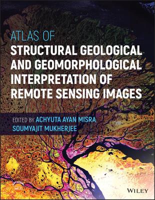
Atlas of Structural Geological and Geomorphological Interpretation of Remote Sensing Images
 -15%
portes grátis
Atlas of Structural Geological and Geomorphological Interpretation of Remote Sensing Images
Mukherjee, Soumyajit; Misra, Achyuta Ayan
John Wiley & Sons Inc
11/2022
272
Dura
Inglês
9781119813354
15 a 20 dias
Descrição não disponível.
Section A: Background
Introduction to "Atlas of Structural Geological and Geomorphological Interpretation of Remote Sensing Images"
Remote Sensing Fundamentals
Classification of Remote Sensing Depending on Data Type, Source, Platform, and Imaging Media
Section B: Geomorphology
Geodynamic Quantification of Mid-Channel Bar Morphology: A Spatio-Temporal Study
Geomorphic Indicators of Glacier Retreat from Jorya-Garang Glacier of Baspa Valley, Himachal Pradesh, India
Aerial Views of the 2018 Kilauea Eruption, Hawaii, U.S.A.
Depositional Systems - An Overview Via Google Earth
The Lateritic Badlands of Garbeta (West Bengal, India)
Geomorphology Along the West Coast of India, Through Remote Sensing
Fluvial Geomorphology in a part of the Spiti River Basin, Himachal Pradesh, India
Section C: Structural Geology
Deformation Bands Mapped in the Miocene Sandstone-Dominated Outcrops, Sengkurong, Brunei Darussalam, SE Asia
Disaggregation Deformation Bands Dominate the Trapping and Sealing Process at The Lion King Fault Zone, Brunei, SE Asia
Surface Deformation Along Katrol Hill Fault, Kachchh, Evidenced by Satellite and DEM Data
Tectonics, Fault Zones, and Topography in the Alaska-Canada Cordillera with a Focus on the Alaska Range and Denali Fault Zone
Use of Remote Sensing in Lineament Analysis
Tectonic Structures Interpretation using Airborne-Based LiDAR DEM on the Examples from the Polish Outer Carpathians
Spatial Variability of Tectonic Influences on Drainage Networks
Archival Airborne Visible/Infrared Imaging Spectrometer (AVIRIS) Image of Faults in a Mixed Carbonate-Clastic Succession, Northwestern Spring Mountains, Nevada, USA
Coseismic Surface Rupture and Related Disaster During the 2018 Mw 7.5 Palu Earthquake, Sulawesi Island, Indonesia
Structural and Alteration Mapping using ASTER imagery and DEM for Gold Mineralization in the Gadag Schist Belt of Karnataka, India
Identifying Subtle Deformation Structures from Satellite Images in Parts of the Mesozoic Kachchh (Kutch) Basin, Kachchh District, Gujarat, India
Lineament Analysis in a Part of the Son River Valley, Madhya Pradesh, India
Meso Scale Sinistral Shear, Eastern Dharwar Craton, Telangana, India
Regional Polyclinal Fold with Faulted Limbs, Rajasthan, India
Drainage Architecture and Bar Formation of the Rangit Tributaries, Darjeeling-Sikkim Himalaya, India
Este título pertence ao(s) assunto(s) indicados(s). Para ver outros títulos clique no assunto desejado.
Remote sensing technology; remote sensing in geology; remote sensing in geomorphology; structural geology; geomorphology; interpreting remotely sensed images; interpreting remote sensing images; remotely sensed image interpretation
Section A: Background
Introduction to "Atlas of Structural Geological and Geomorphological Interpretation of Remote Sensing Images"
Remote Sensing Fundamentals
Classification of Remote Sensing Depending on Data Type, Source, Platform, and Imaging Media
Section B: Geomorphology
Geodynamic Quantification of Mid-Channel Bar Morphology: A Spatio-Temporal Study
Geomorphic Indicators of Glacier Retreat from Jorya-Garang Glacier of Baspa Valley, Himachal Pradesh, India
Aerial Views of the 2018 Kilauea Eruption, Hawaii, U.S.A.
Depositional Systems - An Overview Via Google Earth
The Lateritic Badlands of Garbeta (West Bengal, India)
Geomorphology Along the West Coast of India, Through Remote Sensing
Fluvial Geomorphology in a part of the Spiti River Basin, Himachal Pradesh, India
Section C: Structural Geology
Deformation Bands Mapped in the Miocene Sandstone-Dominated Outcrops, Sengkurong, Brunei Darussalam, SE Asia
Disaggregation Deformation Bands Dominate the Trapping and Sealing Process at The Lion King Fault Zone, Brunei, SE Asia
Surface Deformation Along Katrol Hill Fault, Kachchh, Evidenced by Satellite and DEM Data
Tectonics, Fault Zones, and Topography in the Alaska-Canada Cordillera with a Focus on the Alaska Range and Denali Fault Zone
Use of Remote Sensing in Lineament Analysis
Tectonic Structures Interpretation using Airborne-Based LiDAR DEM on the Examples from the Polish Outer Carpathians
Spatial Variability of Tectonic Influences on Drainage Networks
Archival Airborne Visible/Infrared Imaging Spectrometer (AVIRIS) Image of Faults in a Mixed Carbonate-Clastic Succession, Northwestern Spring Mountains, Nevada, USA
Coseismic Surface Rupture and Related Disaster During the 2018 Mw 7.5 Palu Earthquake, Sulawesi Island, Indonesia
Structural and Alteration Mapping using ASTER imagery and DEM for Gold Mineralization in the Gadag Schist Belt of Karnataka, India
Identifying Subtle Deformation Structures from Satellite Images in Parts of the Mesozoic Kachchh (Kutch) Basin, Kachchh District, Gujarat, India
Lineament Analysis in a Part of the Son River Valley, Madhya Pradesh, India
Meso Scale Sinistral Shear, Eastern Dharwar Craton, Telangana, India
Regional Polyclinal Fold with Faulted Limbs, Rajasthan, India
Drainage Architecture and Bar Formation of the Rangit Tributaries, Darjeeling-Sikkim Himalaya, India
Introduction to "Atlas of Structural Geological and Geomorphological Interpretation of Remote Sensing Images"
Remote Sensing Fundamentals
Classification of Remote Sensing Depending on Data Type, Source, Platform, and Imaging Media
Section B: Geomorphology
Geodynamic Quantification of Mid-Channel Bar Morphology: A Spatio-Temporal Study
Geomorphic Indicators of Glacier Retreat from Jorya-Garang Glacier of Baspa Valley, Himachal Pradesh, India
Aerial Views of the 2018 Kilauea Eruption, Hawaii, U.S.A.
Depositional Systems - An Overview Via Google Earth
The Lateritic Badlands of Garbeta (West Bengal, India)
Geomorphology Along the West Coast of India, Through Remote Sensing
Fluvial Geomorphology in a part of the Spiti River Basin, Himachal Pradesh, India
Section C: Structural Geology
Deformation Bands Mapped in the Miocene Sandstone-Dominated Outcrops, Sengkurong, Brunei Darussalam, SE Asia
Disaggregation Deformation Bands Dominate the Trapping and Sealing Process at The Lion King Fault Zone, Brunei, SE Asia
Surface Deformation Along Katrol Hill Fault, Kachchh, Evidenced by Satellite and DEM Data
Tectonics, Fault Zones, and Topography in the Alaska-Canada Cordillera with a Focus on the Alaska Range and Denali Fault Zone
Use of Remote Sensing in Lineament Analysis
Tectonic Structures Interpretation using Airborne-Based LiDAR DEM on the Examples from the Polish Outer Carpathians
Spatial Variability of Tectonic Influences on Drainage Networks
Archival Airborne Visible/Infrared Imaging Spectrometer (AVIRIS) Image of Faults in a Mixed Carbonate-Clastic Succession, Northwestern Spring Mountains, Nevada, USA
Coseismic Surface Rupture and Related Disaster During the 2018 Mw 7.5 Palu Earthquake, Sulawesi Island, Indonesia
Structural and Alteration Mapping using ASTER imagery and DEM for Gold Mineralization in the Gadag Schist Belt of Karnataka, India
Identifying Subtle Deformation Structures from Satellite Images in Parts of the Mesozoic Kachchh (Kutch) Basin, Kachchh District, Gujarat, India
Lineament Analysis in a Part of the Son River Valley, Madhya Pradesh, India
Meso Scale Sinistral Shear, Eastern Dharwar Craton, Telangana, India
Regional Polyclinal Fold with Faulted Limbs, Rajasthan, India
Drainage Architecture and Bar Formation of the Rangit Tributaries, Darjeeling-Sikkim Himalaya, India
Este título pertence ao(s) assunto(s) indicados(s). Para ver outros títulos clique no assunto desejado.


