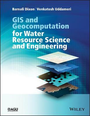
GIS and Geocomputation for Water Resource Science and Engineering
 -15%
portes grátis
GIS and Geocomputation for Water Resource Science and Engineering
Dixon, Barnali; Uddameri, Venkatesh
John Wiley & Sons Inc
02/2016
568
Dura
Inglês
9781118354148
15 a 20 dias
1800
List of Acronyms xvii
Part I GIS, Geocomputation, and GIS Data 1
1 Introduction 3
1.1 What is geocomputation? 3
1.2 Geocomputation and water resources science and engineering 4
1.3 GIS-enabled geocomputation in water resources science and engineering 5
1.4 Why should water resources engineers and scientists study GIS 5
1.5 Motivation and organization of this book 6
1.6 Concluding remarks 7
References 9
2 A Brief History of GIS and Its Use in Water Resources Engineering 11
2.1 Introduction 11
2.2 Geographic Information Systems (GIS) - software and hardware 11
2.3 Remote sensing and global positioning systems and development of GIS 12
2.4 History of GIS in water resources applications 13
2.5 Recent trends in GIS 19
2.6 Benefits of using GIS in water resources engineering and science 20
2.7 Challenges and limitations of GIS-based approach to water resources engineering 20
2.7.1 Limitation 1: incompatibilities between real-world and GIS modeled systems 20
2.7.2 Limitation 2: inability of GIS to effectively handle time dimension 21
2.7.3 Limitation 3: subjectivity arising from the availability of multiple geoprocessing tools 21
2.7.4 Limitation 4: ground-truthing and caution against extrapolation 21
2.7.5 Limitation 5: crisp representation of fuzzy geographic boundaries 21
2.7.6 Limitation 6: dynamic rescaling of maps and intrinsic resampling operations by GIS software 22
2.7.7 Limitation 7: inadequate or improper understanding of scale and resolution of the datasets 22
2.7.8 Limitation 8: limited support for handling of advanced mathematical algorithms 22
2.8 Concluding remarks 23
References 25
3 Hydrologic Systems and Spatial Datasets 27
3.1 Introduction 27
3.2 Hydrological processes in a watershed 27
3.3 Fundamental spatial datasets for water resources planning: management and modeling studies 28
3.3.1 Digital elevation models (DEMs) 28
3.4 Sources of data for developing digital elevation models 30
3.4.1 Accuracy issues surrounding digital elevation models 30
3.5 Sensitivity of hydrologic models to DEM resolution 31
3.5.1 Land use and land cover (LULC) 32
3.5.2 Sources of data for developing digital land use land cover maps 32
3.6 Accuracy issues surrounding land use land cover maps 32
3.6.1 Anderson classification and the standardization of LULC mapping 33
3.7 Sensitivity of hydrologic models to LULC resolution 34
3.7.1 LULC, impervious surface, and water quality 34
3.7.2 Soil datasets 36
3.8 Sources of data for developing soil maps 36
3.9 Accuracy issues surrounding soil mapping 37
3.10 Sensitivity of hydrologic models to soils resolution 38
3.11 Concluding remarks 43
References 44
4 Water-Related Geospatial Datasets 47
4.1 Introduction 47
4.2 River basin, watershed, and subwatershed delineations 47
4.3 Streamflow and river stage data 48
4.4 Groundwater level data 48
4.5 Climate datasets 48
4.6 Vegetation indices 49
4.7 Soil moisture mapping 49
4.7.1 Importance of soil moisture in water resources applications 49
4.7.2 Methods for obtaining soil moisture data 50
4.7.3 Remote sensing methods for soil moisture assessments 50
4.7.4 Role of GIS in soil moisture modeling and mapping 51
4.8 Water quality datasets 51
4.9 Monitoring strategies and needs 51
4.10 Sampling techniques and recent advancements in sensing technologies 52
4.11 Concluding remarks 53
References 53
5 Data Sources and Models 55
5.1 Digital data warehouses and repositories 55
5.2 Software for GIS and geocomputations 55
5.3 Software and data models for water resources applications 59
5.4 Concluding remarks 60
References 60
Part II Foundations of GIS 61
6 Data Models for GIS 63
6.1 Introduction 63
6.2 Data types, data entry, and data models 63
6.2.1 Discrete and continuous data 63
6.3 Categorization of spatial datasets 65
6.3.1 Raster and vector data structures 65
6.3.2 Content-based data classification 65
6.3.3 Data classification based on measurement levels 66
6.3.4 Primary and derived datasets 69
6.3.5 Data entry for GIS 69
6.3.6 GIS data models 70
6.4 Database structure, storage, and organization 71
6.4.1 What is a relational data structure? 71
6.4.2 Attribute data and tables 72
6.4.3 Geodatabase 73
6.4.4 Object-oriented database 75
6.5 Data storage and encoding 75
6.6 Data conversion 76
6.7 Concluding remarks 78
References 80
7 Global Positioning Systems (GPS) and Remote Sensing 81
7.1 Introduction 81
7.2 The global positioning system (GPS) 81
7.3 Use of GPS in water resources engineering studies 82
7.4 Workflow for GPS data collection 83
7.4.1 12 Steps to effective GPS data collection and compilation 83
7.5 Aerial and satellite remote sensing and imagery 83
7.5.1 Low-resolution imagery 84
7.5.2 Medium-resolution imagery 84
7.5.3 High-resolution imagery 84
7.6 Data and cost of acquiring remotely sensed data 84
7.7 Principles of remote sensing 85
7.8 Remote sensing applications in water resources engineering and science 88
7.9 Bringing remote sensing data into GIS 91
7.9.1 Twelve steps for integration of remotely sensed data into GIS 93
7.10 Concluding remarks 94
References 95
8 Data Quality, Errors, and Uncertainty 97
8.1 Introduction 97
8.2 Map projection, datum, and coordinate systems 97
8.3 Projections in GIS software 101
8.4 Errors, data quality, standards, and documentation 102
8.5 Error and uncertainty 106
8.6 Role of resolution and scale on data quality 107
8.7 Role of metadata in GIS analysis 109
8.8 Concluding remarks 109
References 109
9 GIS Analysis: Fundamentals of Spatial Query 111
9.1 Introduction to spatial analysis 111
9.2 Querying operations in GIS 116
9.2.1 Spatial query 116
9.3 Structured query language (SQL) 119
9.4 Raster data query by cell value 122
9.5 Spatial join and relate 125
9.6 Concluding remarks 128
References 128
10 Topics in Vector Analysis 129
10.1 Basics of geoprocessing (buffer, dissolve, clipping, erase, and overlay) 129
10.1.1 Buffer 129
10.1.2 Dissolve, clip, and erase 132
10.1.3 Overlay 132
10.2 Topology and geometric computations (various measurements) 137
10.2.1 Length and distance measurements 139
10.2.2 Area and perimeter-to-area ratio (PAR) calculations 140
10.3 Proximity and network analysis 143
10.3.1 Proximity 144
10.3.2 Network analysis 144
10.4 Concluding remarks 145
References 147
11 Topics in Raster Analysis 149
11.1 Topics in raster analysis 149
11.2 Local operations 149
11.2.1 Local operation with a single raster 151
11.2.2 Local operation with multiple rasters 151
11.2.3 Map algebra for geocomputation in water resources 153
11.3 Reclassification 155
11.4 Zonal operations 157
11.4.1 Identification of regions and reclassification 160
11.4.2 Category-wide overlay 161
11.5 Calculation of area, perimeter, and shape 163
11.6 Statistical operations 164
11.7 Neighborhood operations 165
11.7.1 Spatial aggregation analysis 165
11.7.2 Filtering 166
11.7.3 Computation of slope and aspect 167
11.7.4 Resampling 167
11.8 Determination of distance, proximity, and connectivity in raster 167
11.9 Physical distance and cost distance analysis 169
11.9.1 Cost surface analysis 172
11.9.2 Allocation and direction analysis 172
11.9.3 Path analysis 173
11.10 Buffer analysis in raster 174
11.11 Viewshed analysis 175
11.12 Raster data management (mask, spatial clip, and mosaic) 178
11.13 Concluding remarks 179
References 181
12 Terrain Analysis and Watershed Delineation 183
12.1 Introduction 183
12.1.1 Contouring 184
12.1.2 Hill shading and insolation 185
12.1.3 Perspective view 186
12.1.4 Slope and aspect 186
12.1.5 Surface curvature 191
12.2 Topics in watershed characterization and analysis 191
12.2.1 Watershed delineation 192
12.2.2 Critical considerations during watershed delineation 198
12.3 Concluding remarks 200
References 200
Part III Foundations of Modeling 203
13 Introduction to Water Resources Modeling 205
13.1 Mathematical modeling in water resources engineering and science 205
13.2 Overview of mathematical modeling in water resources engineering and science 206
13.3 Conceptual modeling: phenomena, processes, and parameters of a system 206
13.4 Common approaches used to develop mathematical models in water resources engineering 206
13.4.1 Data-driven models 207
13.4.2 Physics-based models 208
13.4.3 Expert-driven or stakeholder-driven models 208
13.5 Coupling mathematical models with GIS 209
13.5.1 Loose coupling of GIS and mathematical models 209
13.5.2 Tight coupling of GIS and mathematical models 209
13.5.3 What type of coupling to pursue? 210
13.6 Concluding remarks 210
References 211
14 Water Budgets and Conceptual Models 213
14.1 Flow modeling in a homogeneous system (boxed or lumped model) 213
14.2 Flow modeling in heterogeneous systems (control volume approach) 215
14.3 Conceptual model: soil conservation survey curve number method 217
14.4 Fully coupled watershed-scale water balance model: soil water assessment tool (SWAT) 218
14.5 Concluding remarks 219
References 220
15 Statistical and Geostatistical Modeling 221
15.1 Introduction 221
15.2 Ordinary least squares (OLS) linear regression 221
15.3 Logistic regression 222
15.4 Data reduction and classification techniques 223
15.5 Topics in spatial interpolation and sampling 223
15.5.1 Local area methods 224
15.5.2 Spline interpolation method 224
15.5.3 Thiessen polygons 224
15.5.4 Density estimation 225
15.5.5 Inverse distance weighted (IDW) 226
15.5.6 Moving average 226
15.5.7 Global area or whole area interpolation schemes 227
15.5.8 Trend surface analysis 227
15.6 Geostatistical Methods 227
15.6.1 Spatial autocorrelation 227
15.6.2 Variogram and semivariogram modeling 228
15.7 Kriging 230
15.8 Critical issues in interpolation 231
15.9 Concluding remarks 232
References 234
16 Decision Analytic and Information Theoretic Models 235
16.1 Introduction 235
16.2 Decision analytic models 235
16.2.1 Multiattribute decision-making models 235
16.2.2 Multiobjective decision-making models 238
16.3 Information theoretic approaches 238
16.3.1 Artificial neural networks (ANNs) 239
16.3.2 Support vector machines (SVMs) 239
16.3.3 Rule-based expert systems 240
16.3.4 Fuzzy rule-based inference systems 241
16.3.5 Neuro-fuzzy systems 243
16.4 Spatial data mining (SDM) for knowledge discovery in a database 245
16.5 The trend of temporal data modeling in GIS 245
16.6 Concluding remarks 246
References 246
17 Considerations for GIS and Model Integration 249
17.1 Introduction 249
17.2 An overview of practical considerations in adopting and integrating GIS into water resources projects 250
17.3 Theoretical considerations related to GIS and water resources model integration 251
17.3.1 Space and time scales of the problems and target outcomes 251
17.3.2 Data interchangeability and operability 253
17.3.3 Selection of the appropriate platform, models, and datasets 253
17.3.4 Model calibration and evaluation issues 255
17.3.5 Error and uncertainty analysis 255
17.4 Concluding remarks 256
References 257
18 Useful Geoprocessing Tasks While Carrying Out Water Resources Modeling 259
18.1 Introduction 259
18.2 Getting all data into a common projection 259
18.3 Adding point (X, Y) data and calculating their projected coordinates 260
18.4 Image registration and rectification 264
18.5 Editing tools to transfer information to vectors 266
18.6 GIS for cartography and visualization 270
18.7 Concluding remarks 271
References 271
19 Automating Geoprocessing Tasks in GIS 273
19.1 Introduction 273
19.2 Object-oriented programming paradigm 273
19.3 Vectorized (array) geoprocessing 274
19.4 Making nongeographic attribute calculations 274
19.4.1 Field calculator for vector attribute manipulation 274
19.4.2 Raster calculator for continuous data 278
19.5 Using ModelBuilder to automate geoprocessing tasks 279
19.6 Using Python scripting for geoprocessing 287
19.7 Introduction to some useful Python constructs 288
19.7.1 Basic arithmetic and programming logic syntax 288
19.7.2 Defining functions in Python 288
19.7.3 Python classes 288
19.7.4 Python modules and site-packages 289
19.8 ArcPy geoprocessing modules and site-package 289
19.9 Learning Python and scripting with ArcGIS 289
19.10 Concluding remarks 290
References 291
Part IV Illustrative Case Studies 293
A Preamble to Case Studies 295
20 Watershed Delineation 297
20.1 Introduction 297
20.2 Background 297
20.3 Methods 298
20.3.1 Generalized methods 298
20.3.2 Application 298
20.3.3 Application of ArcGIS Spatial Analyst tools 298
20.3.4 Application of ArcHydro for drainage analysis using digital terrain data 303
20.4 Concluding remarks 311
References 311
21 Loosely Coupled Hydrologic Model 313
21.1 Introduction 313
21.2 Study area 313
21.3 Methods 314
21.3.1 Image processing 315
21.3.2 ET/EV data 317
21.3.3 Accuracy assessment 317
21.3.4 Water budget spreadsheet model 317
21.4 Results and discussions 318
21.4.1 Image classification results 318
21.4.2 Water budget calculation 319
21.5 Conclusions 323
Acknowledgment 324
References 324
22 Watershed Characterization 325
22.1 Introduction 325
22.2 Background 325
22.3 Approach 326
22.3.1 Analysis of watershed characteristics and reclassification 327
22.3.2 Integrated evaluation of watershed runoff potential 330
22.4 Summary and conclusions 332
References 345
23 Tightly Coupled Models with GIS for Watershed Impact Assessment 347
23.1 Introduction 347
23.1.1 Land use and soil influences on runoff and the curve number (CN) 347
23.2 Methods 350
23.2.1 Study area 350
23.2.2 Data processing 350
23.2.3 Data layers 351
23.3 Results and discussion 353
23.4 Summary and conclusions 357
References 357
24 GIS for Land Use Impact Assessment 359
24.1 Introduction 359
24.2 Description of study area and datasets 360
24.3 Results and discussion 370
24.4 Conclusions 386
References 387
25 TMDL Curve Number 389
25.1 Introduction 389
25.2 Formulation of competing models 389
25.3 Use of Geographic Information System to obtain parameters for use in the NRCS method 390
25.3.1 Nonpoint source loading determination 391
25.4 Risk associated with different formulations 392
25.5 Summary and conclusions 394
References 395
26 Tight Coupling MCDM Models in GIS 397
26.1 Introduction 397
26.2 Using GIS for groundwater vulnerability assessment 398
26.3 Application of DRASTIC methodology in South Texas 398
26.4 Study area 398
26.5 Compiling the database for the DRASTIC index 398
26.6 Development of DRASTIC vulnerability index 399
26.6.1 Depth to groundwater 400
26.6.2 Recharge 401
26.6.3 Aquifer media 401
26.6.4 Soil media 401
26.6.5 Topography 402
26.6.6 Impact of vadose zone 402
26.6.7 Hydraulic conductivity 403
26.7 DRASTIC index 403
26.8 Summary 404
References 404
27 Advanced GIS MCDM Model Coupling for Assessing Human Health Risks 405
27.1 Introduction 405
27.2 Background information 406
27.2.1 Groundwater vulnerability parameters 406
27.2.2 Pathogen transport parameters 406
27.2.3 Pathogen survival parameters 407
27.3 Methods 407
27.3.1 Study area 407
27.3.2 Conceptual framework 407
27.3.3 Data layers 408
27.4 Results and discussion 412
27.5 Conclusions 419
References 419
28 Embedded Coupling with JAVA 421
28.1 Introduction 421
28.2 Previous work 422
28.3 Mathematical background 422
28.4 Data formats of input files 423
28.5 AFC structure and usage 423
28.6 Illustrative example 424
References 426
29 GIS-Enabled Physics-Based Contaminant Transport Models for MCDM 427
29.1 Introduction 427
29.2 Methodology 428
29.2.1 Conceptual model 428
29.2.2 Mass-balance expressions 429
29.2.3 Solutions of the steady-state mass-balance equation 430
29.2.4 Model parameterization 431
29.3 Results and discussion 433
29.3.1 Sensitivity analysis 435
29.4 Summary and conclusions 437
References 437
30 Coupling of Statistical Methods with GIS for Groundwater Vulnerability Assessment 439
30.1 Introduction 439
30.1.1 Logistic regression 439
30.1.2 Akaike's information criterion (AIC) 440
30.2 Methodology 440
30.2.1 Application of logistic regression (LR) to DRASTIC vulnerability model 440
30.2.2 Implementation in GIS 440
30.3 Results and discussion 440
30.3.1 Implementation in GIS 441
30.4 Summary and conclusions 444
References 444
31 Coupling of Fuzzy Logic-Based Method with GIS for Groundwater Vulnerability Assessment 447
31.1 Introduction 447
31.2 Methodology 448
31.2.1 Fuzzy sets and fuzzy numbers 448
31.2.2 Fuzzy arithmetic 449
31.2.3 Elementary fuzzy arithmetic for triangular fuzzy sets 449
31.2.4 Approximate operations on triangular fuzzy sets 449
31.2.5 Fuzzy aquifer vulnerability characterization 450
31.2.6 Specification of weights 450
31.2.7 Specification of ratings 450
31.2.8 Defuzzification procedures 452
31.2.9 Implementation 453
31.3 Results and discussion 453
31.3.1 Incorporation of fuzziness in decision-makers' weights and ratings 453
31.3.2 Comparison of exact and approximate fuzzy arithmetic for aquifer vulnerability estimation when ratings and weights are fuzzy 453
31.4 Summary and conclusions 457
References 457
32 Tight Coupling of Artificial Neural Network (ANN) and GIS 461
32.1 Introduction 461
32.1.1 The concept of artificial neural network (ANN) 461
32.2 Methodology 463
32.2.1 Data development 463
32.2.2 Application of feedforward neural network (FFNN) to DRASTIC groundwater vulnerability assessment model 463
32.2.3 Application of radial basis function (RBF) neural network to DRASTIC groundwater vulnerability assessment model 464
32.2.4 Performance evaluation of feedforward neural network (FFNN) and radial basis function (RBF) neural network models 464
32.2.5 Implementation of artificial neural network in GIS 465
32.3 Results and discussion 465
32.3.1 Model performance evaluation for FFNN and RBF network models 468
32.3.2 Results of ANN-GIS integration 472
32.4 Summary and conclusion 472
References 473
33 Loose Coupling of Artificial Neuro-Fuzzy Information System (ANFIS) and GIS 475
33.1 Introduction 475
33.2 Methods 475
33.2.1 Study area 475
33.2.2 Data development 476
33.2.3 Selection of the model inputs 476
33.2.4 Development of artificial neuro-fuzzy models 477
33.3 Results and discussion 478
33.4 Conclusions 479
References 480
34 GIS and Hybrid Model Coupling 483
34.1 Introduction 483
34.2 Methodology 483
34.2.1 Multicriteria decision-making model for assessing recharge potential 484
34.2.2 Data compilation and GIS operations 485
34.3 Results and discussion 486
34.3.1 Identification of potential recharge areas and model evaluation 486
34.3.2 Hydrogeological and geochemical assessment of identified recharge locations 490
34.3.3 Artificial recharge locations in the context of demands 491
34.4 Summary and conclusions 493
References 493
35 Coupling Dynamic Water Resources Models with GIS 495
35.1 Introduction 495
35.2 Modeling infiltration: Green-Ampt approach 495
35.3 Coupling Green-Ampt modeling with regional-scale soil datasets 497
35.4 Result and discussion 497
35.5 Summary 498
References 499
36 Tight Coupling of Well Head Protection Models in GIS with Vector Datasets 501
36.1 Introduction 501
36.2 Methods for delineating well head protection areas 501
36.3 Fixed radius model development 502
36.4 Implementing well head protection models within GIS 503
36.5 Data compilation 503
36.6 Results and discussion 504
36.6.1 Arbitrary fixed radius buffer 504
36.6.2 Calculated variable radius buffer 504
36.7 Summary 505
References 506
37 Loosely Coupled Models in GIS for Optimization 507
37.1 Introduction 507
37.2 Study area 508
37.3 Mathematical model 509
37.4 Data compilation and model application 510
37.5 Results 511
37.5.1 Baseline run 511
37.5.2 Evaluation of certificate of convenience and necessity delineations 512
37.5.3 Impacts of wastewater treatment efficiencies 512
37.5.4 Impacts of influent characteristics 513
37.5.5 Evaluation of current and future effluent discharge policies 513
37.6 Summary and conclusions 513
References 514
38 Epilogue 515
References 517
Example of a Syllabus: For Graduate 6000 Level Engineering Students 519
Example of a Syllabus: For Graduate 6000 Level Environmental Science and Geography Students 523
Example of a Syllabus: For Undergraduate 4000 Level Engineering Students 527
Example of a Syllabus: For Undergraduate 4000 Level Environmental Science and Geography Students 531
Index 535

