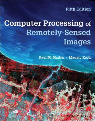
Computer Processing of Remotely-Sensed Images
 -15%
portes grátis
Computer Processing of Remotely-Sensed Images
Koch, Magaly; Mather, Paul M.
John Wiley and Sons Ltd
04/2022
384
Mole
Inglês
9781119502821
15 a 20 dias
1050
Preface to the Second Edition
Preface to the Third Edition
Preface to the Fourth Edition
Preface to the Fifth Edition
List of Examples
Chapter 1: Remote Sensing: Basic Principles
1.1 Introduction
1.2 Electromagnetic radiation and its properties
1.2.1 Terminology
1.2.2 Nature of electromagnetic radiation
1.2.3 The electromagnetic spectrum
1.2.4 Sources of electromagnetic radiation
1.2.5 Interactions with the Earth's atmosphere
1.3 Interaction with Earth surface materials
1.3.1 Introduction
1.3.2 Spectral reflectance of Earth surface materials
1.3.2.1 Vegetation
1.3.2.2 Geology
1.3.2.3 Water bodies
1.3.2.4 Soils
1.4 Summary
References
Chapter 2: Remote Sensing Platforms and Sensors
2.1 Introduction
2.2 Characteristics of imaging remote sensing instruments
2.2.1 Spatial resolution
2.2.2 Spectral resolution
2.2.3 Radiometric resolution
2.3 Optical, near-infrared and thermal imaging sensors
2.3.1 Along-Track Scanning Radiometer (ATSR)
2.3.2 Advanced Very High Resolution Radiometer (AVHRR) and Visible Infrared Imager Radiometer Suite (VIIRS)
2.3.3 MODIS (MODerate Resolution Imaging Spectrometer)
2.3.4 Ocean observing instruments
2.3.5 IRS LISS
2.3.6 Landsat instruments
2.3.6.1 Landsat Multi-Spectral Scanner (MSS)
2.3.6.2 Landsat Thematic Mapper (TM)
2.3.6.3 Enhanced Thematic Mapper Plus (ETM+)
2.3.6.4 Landsat 8
2.3.6.5 Landsat 9
2.3.6.6 Landsat Next
2.3.7 SPOT sensors
2.3.7.1 SPOT High Resolution Visible (HRV)
2.3.7.2 Vegetation (VGT)
2.3.7.3 SPOT Follow-on Programme
2.3.8 Advanced Spaceborne Thermal Emission and Reflection Radiometer (ASTER)
2.3.9ESA Sentinel Programme
2.3.9.1 Sentinel-2 Multi-Spectral Imager (MSI)
2.3.9.2 Sentinel-3 OLCI and SLSTR
2.3.10 High-resolution commercial and small satellite systems
2.4 Microwave imaging sensors
2.4.1. European Space Agency Synthetic Aperture Spaceborne Radars
2.4.2 Radarsat
2.4.3 TerraSAR-X and COSMO-SkyMed
2.4.3 ALOS PALSAR
2.4.4 Sentinel-1 SAR
2.5 Summary
References
Chapter 3: Pre-Processing of Remotely Sensed Data
3.1 Introduction
3.2 Cosmetic operations
3.2.1 Missing scan lines
3.2.2 De-striping methods
3.2.2.1 Linear method
3.2.2.2 Histogram matching
3.2.2.3 Other de-striping methods
3.3 Geometric correction and registration
3.3.1 Orbital geometry model
3.3.2 Transformation based on ground control points
3.3.3 Resampling procedures
3.3.4 Image registration
3.3.5 Other geometric correction methods
3.4 Atmospheric correction
3.4.1 Background
3.4.2 Image-based methods
3.4.3 Radiative transfer models
3.4.4 Empirical line method
3.5 Illumination and view angle effects
3.6 Sensor calibration
3.7 Terrain effects
3.8 Summary
References
Chapter 4: Image Enhancement Techniques
4.1 Introduction
4.2 Human visual system
4.3 Contrast enhancement
4.3.1 Linear contrast stretch
4.3.2 Histogram equalisation
4.3.3 Gaussian stretch
4.4 Pseudocolour enhancement
4.4.1 Density slicing
4.4.2 Pseudocolour transform
4.5 Summary
References
Chapter 5: Image Transforms
5.1 Introduction
5.2 Arithmetic operations
5.2.1 Image addition
5.2.2 Image subtraction
5.2.3 Image multiplication
5.2.4 Image division and vegetation indices
5.3 Empirically based image transforms
5.3.1 Perpendicular Vegetation Index
5.3.2 Tasselled Cap (Kauth-Thomas) transformation
5.4 Principal Components Analysis
5.4.1 Standard Principal Components Analysis
5.4.2 Noise-adjusted Principal Components Analysis
5.4.3 Decorrelation stretch
5.5 Hue, Saturation and Intensity (HSI) transform
5.6 The Discrete Fourier Transform
5.6.1 Introduction
5.6.2 Two-dimensional Fourier transform
5.6.3 Applications of the Fourier transform
5.7 The Discrete Wavelet Transform
5.7.1 Introduction
5.7.2 The one-dimensional Discrete Wavelet Transform
5.7.3 The two-dimensional Discrete Wavelet Transform
5.8 Change Detection
5.8.1 Introduction
5.8.2 NDVI Difference Image
5.8.3 Principal Components Analysis
5.8.4 Canonical Correlation Change Analysis
5.8.5 Time Series Analysis
5.8.6 Summary
5.9 Image fusion
5.9.1 Introduction
5.9.2 Hue, Saturation and Intensity (HSI) algorithm.
5.9.3 Principal Components Analysis
5.9.4 Gram-Schmidt orthogonalisation
5.9.5 Wavelet based methods
5.9.6 Evaluation - Subjective methods
5.9.7 Evaluation - Objective methods
5.10 Summary
References
Chapter 6: Filtering Techniques
6.1 Introduction
6.2 Spatial domain low-pass (smoothing) filters
6.2.1 Moving average filter
6.2.2 Median filter
6.2.3 Adaptive filters
6.3 Spatial domain high-pass (sharpening) filters
6.3.1 Image subtraction method
6.3.2 Derivative-based methods
6.4 Spatial domain edge detectors
6.5 Frequency domain filters
6.6 Summary
References
Chapter 7: Classification
7.1 Introduction
7.2 Geometrical basis of classification
7.3 Unsupervised classification
7.3.1 The k-means algorithm
7.3.2 ISODATA
7.3.3 A modified k-means algorithm
7.4 Supervised classification
7.4.1 Training samples
7.4.2 Statistical classifiers
7.4.2.1 Parallelepiped classifier
7.4.2.2 Centroid (k-means) classifier
7.4.2.3 Maximum likelihood method
7.4.3 Neural classifiers
7.5 Sub-pixel classification techniques
7.5.1 The linear mixture model
7.5.2 Spectral Angle Mapping
7.5.3 Independent Components Analysis
7.5.4 Fuzzy classifiers
7.6 More advanced approaches to image classification
7.6.1 Support Vector Machines
7.6.2 Decision tree classifiers
7.6.3 Other approaches to classification
7.6.3.1Rule based methods and the Genetic Algorithm
7.6.3.2Object-oriented methods
7.6.3.3Other methods
7.6.3.3.1Evidential Reasoning
7.6.3.3.2Bagging, boosting and ensembles of classifiers
7.7 Incorporation of non-spectral features
7.7.1 Texture
7.7.2 Use of external data
7.8 Contextual information
7.9 Feature selection
7.10 Classification accuracy
7.11 Summary
References
Chapter 8 Advanced Topics
8.1 Introduction
8.2 SAR interferometry
8.2.1 Basic principles
8.2.2 Interferometric processing
8.2.3 Problems in SAR interferometry
8.2.4 Applications of SAR interferometry
8.3 Imaging spectroscopy
8.3.1 Introduction
8.3.2 Processing imaging spectrometer data
8.3.2.1 Derivative analysis
8.3.2.2 Smoothing and denoising the reflectance spectrum
8.3.2.2.1 Savitzky-Golay polynomial smoothing
8.3.2.2.2 Denoising using the Discrete Wavelet Transform
8.3.2.3 Determination of 'red edge' characteristics of vegetation
8.3.2.4 Continuum removal
8.4 Lidar
8.4.1 Introduction
8.4.2 Lidar details
8.4.3 Lidar applications
8.5 Summary
References
Appendix A
Index

